Jim Reed: Storm Chaser
 Weather photographer Jim Reed's unique and long-term project shot over 15 years, "Storm Chaser: A Photographer's Journey," provides 175 stunning images of America's changing climate and record-setting storms, including hurricanes and tornadoes.
 |
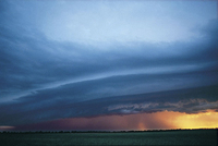 A severe thunderstorm with striated shelf cloud strikes Butler County, Kansas, at sunset on July 25, 1995.
 |
 Fair weather cumulus clouds hover over a freshly made highway in eastern Washington on Oct. 6, 1995.
 |
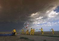 Members of S.T.E.P.S. (Severe Thunderstorm Electrification and Precipitation Study) launch a weather balloon into a tornadic supercell thunderstorm in northwest Kansas on May 29, 2000.
 |
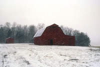 A winter storm with blizzard-like conditions strikes eastern Tennessee on Jan. 10, 1997.
 |
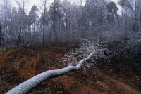 Trees tumble as an ice storm strikes northern Georgia on Jan. 9, 1997.
 |
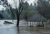 Flooding occurs in Malibu, California, in February 1998.
 |
 Downtown Clarksville, Tennessee, lies in ruins following an F-3 twister in January 1999.
 |
 A significant hoar frost event envelops Sedgwick County, Kansas, yielding a true winter wonderland on Dec. 28, 2000.
 |
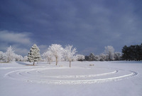 Hoarfrost-covered trees overlook circular tire tracks in the snow in Wichita, Kansas, on Dec. 28, 2000.
 |
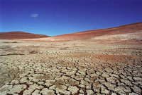 The symptoms of global warming were clear in the Lake Powell, Utah, area as early as the spring of 1995.
 |
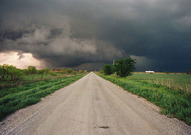 A tornadic thunderstorm with wall cloud strikes western Oklahoma on April 17, 1995.
 |
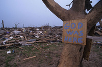 Victims of disasters frequently create therapeutically-made messages following a storm. On May 3, 1999, Moore, Oklahoma, was devastated by an F-5 tornado that struck with record-setting winds in excess of 300 mph.
 |
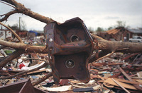 An F-5 tornado with winds around 300 mph wrapped this steel sink around a tree branch in Moore, Oklahoma, on May 3, 1999.
 |
 This storm shelter saved the lives of a Moore, Oklahoma, family during a violent twister on May 3, 1999. It was the first time in recorded history that an F-5 tornado hit the Oklahoma City metro area.
 |
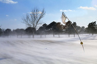 Windblown snow and frigid temperatures impact a golf course in Wichita, Kansas on March 2, 2002.
 |
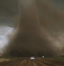 An Kansas state trooper throws his car into reverse to escape the path of a tornado near Pretty Prairie, Kansas, on April 11, 2002. It was the first Kansas twister of the season.
 |
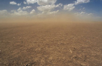 A dust storm roars across a drought-stricken farm field in western Kansas on May 11, 2004.
 |
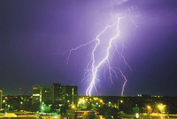 An electrical storm erupts over downtown Wichita, Kansas, on July 20, 2000.
 |
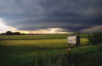 A mesocyclone rotates over northeast Kansas on June 5, 1996. The storm produced baseball-size hailstones and prompted a tornado warning.
 |
 A vibrant double rainbow shimmers on the backside of a tornadic thunderstorm in Cowley County, Kansas, on June 8, 1998.
 |
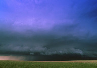 A severe thunderstorm develops over Kiowa County, Kansas, on June 13, 2000.
 |
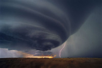 A lone lightning bolt strikes the ground beneath an isolated supercell thunderstorm at sunset near Medicine Lodge, Kansas, on June 5, 2004.
 |
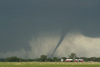 Double trouble: Simultaneous tornadoes threaten Turner County, South Dakota, on June 24, 2003. It was the largest single-day outbreak of tornadoes in South Dakota's history.
 |
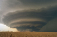 An isolated supercell thunderstorm threatens south-central Kansas on June 5, 2004. The flying saucer-shaped severe storm produced baseball-size hailstones.
 |
 Mammatus clouds develop on the edge of a severe thunderstorm in northern Oklahoma on June 16, 2005.
 |
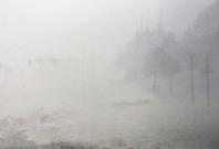 Hurricane Katrina's historic storm surge roars across U.S. Route 90 in Gulfport, Mississippi, on Aug. 29, 2005.
 |
 Hurricane videographer Mike Theiss clutches a road sign for balance during Hurricane Katrina in Gulfport, Mississippi, on Aug. 29, 2005. Theiss was attempting to reach shelter when a strong gust forced him to stop.
 |
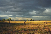 Thunderstorms develop near Roosevelt, Utah, on Sept. 11, 1994.
 |
 Stormy weather motivated these monarch butterflies to seek refuge on a sunflower in Scott County, Kansas, on Sept. 16, 1996.
 |
 Jim Reed during Hurricane Frances on September 4, 2004.
 |
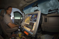 Storm chaser Tim Samaras monitors radar from inside his chase vehicle on June 8, 2005.
 |
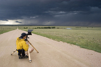 Jim Reed documenting a storm in eastern Colorado on May 31, 2006.
 |
 Research meteorologist Jon Davies uses a laptop computer inside his chase vehicle to monitor a developing storm in the Central Plains on May 20, 2004.
 |
|
|
|